Title
Photogrammetry Application on Ground Settlement Monitoring in Semantok DAM
Category
Case Study & Document
Description
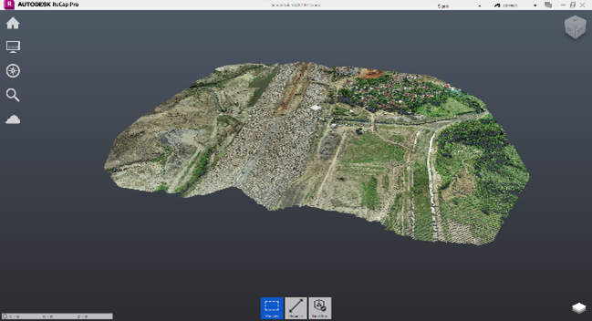
Ground settlement poses a great challenge to engineers in the industry, as at the early of construction project, a proper and systematic project monitoring is crucial to ensure that the overall construction is executed based on cost and schedule projection. While project monitoring extends through several major focus areas concerning the performance of the workers, productivity levels, and safety. Under those circumstances, an extensive project monitoring covering vertical movements is needed to analyze the possible ground settlement. UAV (Unmanned Aerial Vehicle) Drone is used to obtain orthophotos for further analysis. A traditional approach was also used, data obtained using total station is used and is compared to the results of the digital survey. These two technologies possess their own distinctive pull factors and are characterized further with different data characteristics acquired. This study also concluded that photogrammetry is a feasible alternative approach in quantifying ground settlement
In Collaboration with PT. Hutama Karya (Persero), Jakarta, Indonesia
Contact Us
km@binus.edu